
DOI:
https://doi.org/10.14483/22487638.20628Publicado:
21-09-2025Número:
Vol. 30 Núm. 89 (2026): Julio - SeptiembreSección:
InvestigaciónDesign and Initial Development of a Virtual Learning Object for Self-Directed Learning in Land-Use and Land-Cover Mapping
Diseño y desarrollo inicial de un objeto virtual de aprendizaje para el aprendizaje autónomo en la elaboración de mapas de uso y cobertura del suelo
Palabras clave:
land-cover mapping, land-use mapping, semantic segmentation, self-directed learning, virtual learning object (en).Palabras clave:
aprendizaje autónomo, mapas de cobertura del suelo, mapas de uso del suelo, objeto virtual de aprendizaje, segmentación semántica (es).Descargas
Resumen (en)
Objective: To design and implement the first phase of a virtual learning object (VLO) that supports asynchronous interaction between tutors and students and enables quality assessment of student-produced land-use and land-cover maps. Methodology: An open-source web environment was developed to manage the learning process from the initial assignment to final submission. The environment supports automated assessment of geometric and semantic consistency.
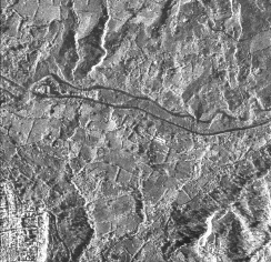
Results: The environment was tested with students in the GEIPER Remote Sensing and Geographic Information Systems research group, which is affiliated with the NIDE Spatial Data Research Group at Universidad Distrital Francisco José de Caldas. The tests used recent 0.5 m-resolution Capella radar imagery of Cáqueza, Cundinamarca, Colombia, and involved students in Cadastral Engineering and Geodesy.
Conclusions: The tests indicate that the proposed environment is a sustainable alternative for improving teaching and learning in the Earth sciences, particularly the development of skills required to produce high-quality land-use and landcover maps.
Resumen (es)
Objetivo: Diseñar e implementar la primera fase de un objeto virtual de aprendizaje (OVA) que facilite la interacción asíncrona entre tutores y estudiantes y permita evaluar la calidad de los mapas de uso y cobertura del suelo elaborados por los estudiantes.
Metodología: Se desarrolló un entorno web de código abierto para gestionar el proceso de aprendizaje desde la asignación inicial hasta la entrega final. El entorno permite evaluar de manera automatizada la consistencia geométrica y semántica.
Resultados: El entorno se probó con estudiantes del semillero de investigación GEIPER en Teledetección y Sistemas de Información Geográfica, adscrito al grupo de investigación NIDE en Datos Espaciales de la Universidad Distrital Francisco José de Caldas. Las pruebas utilizaron imágenes de radar recientes de Capella, con una resolución de 0,5 m, correspondientes a Cáqueza, Cundinamarca, Colombia, y contaron con la participación de estudiantes de Ingeniería Catastral y Geodesia.
Conclusiones: Las pruebas indican que el entorno propuesto constituye una alternativa sostenible para mejorar los procesos de enseñanza y aprendizaje en ciencias de la Tierra, en particular el desarrollo de las competencias necesarias para producir mapas de uso y cobertura del suelo de alta calidad.
Referencias
[1] D. Martin, C. Fowlkes, D. Tal, and J. Malik, "A database of human segmented natural images and its application to evaluating segmentation algorithms and measuring ecological statistics," in Proc. 8th IEEE Int. Conf. Computer Vision (ICCV), Vancouver, BC, Canada, 2001, vol. 2, pp. 416–423, doi: https://doi.org/10.1109/ICCV.2001.937655.
[2] P. Mejias, O. Herrera, A. Mellado, and M. Faundez, "Virtual learning objects and LMS, a strategic alliance between the teaching-learning process and generic competences," in Proc. XVI Latin American Conf. Learning Technologies (LACLO), Arequipa, Peru, 2021, pp. 546–549, doi: https://doi.org/10.1109/LACLO54177.2021.00099.
[3] Z. Nurbekova, B. Nurbekov, M. Maulsharif, D. Naimanova, and A. Baimendinova, "Using virtual learning objects in educational content," in Proc. 23rd Int. Conf. Computer Systems and Technologies (CompSysTech '22), Ruse, Bulgaria, 2022, pp. 174–178, doi: https://doi.org/10.1145/3546118.3546138.
[4] P. Arbeláez, M. Maire, C. Fowlkes, and J. Malik, "Contour detection and hierarchical image segmentation," IEEE Trans. Pattern Anal. Mach. Intell., vol. 33, no. 5, pp. 898–916, May 2011, doi: https://doi.org/10.1109/TPAMI.2010.161.
[5] International Federation of Surveyors, Enhancing Surveying Education through e-Learning, FIG Publication no. 46. Copenhagen, Denmark: FIG, 2010. [Online]. Available: https://www.fig.net/resources/publications/figpub/pub46/figpub46.pdf
[6] L. Groenendijk, P. van der Molen, C. Lemmen, and T. Wubbe, "E-learning: The future for land administration studies?" in Proc. XXIV FIG Int. Congress: Facing the Challenges—Building the Capacity, Sydney, Australia, 2010. [Online]. Available: https://www.fig.net/resources/proceedings/fig_proceedings/fig2010/papers/ts06g/ts06g_groenendijk_lemmen_et_al_3935.pdf
[7] Capella Space, "Synthetic aperture radar data." [Online]. Available: https://www.capellaspace.com/solution/sar-data. [Accessed: Aug. 18, 2026].
[8] S. Rahman, N. Hossain, M. A. Hossain, and M. Hossain, "OAuth 2.0: A framework to secure the OAuth-based service for packaged web application," in Innovative Perspectives on Interactive Communication Systems and Technologies, M. Sarfraz, Ed. Hershey, PA, USA: IGI Global, 2020, ch. 5, pp. 92–139, doi: https://doi.org/10.4018/978-1-7998-3355-0.ch005.
[9] Y.-T. Shen, H. Lee, H. Kwon, and S. S. Bhattacharyya, "Progressive transformation learning for leveraging virtual images in training," in Proc. IEEE/CVF Conf. Computer Vision and Pattern Recognition (CVPR), Vancouver, BC, Canada, 2023, pp. 835–844, doi: https://doi.org/10.1109/CVPR52729.2023.00087.
[10] Y. Tian, X. Li, K. Wang, and F.-Y. Wang, "Training and testing object detectors with virtual images," IEEE/CAA J. Autom. Sinica, vol. 5, no. 2, pp. 539–546, Mar. 2018, doi: https://doi.org/10.1109/JAS.2017.7510841.
Cómo citar
APA
ACM
ACS
ABNT
Chicago
Harvard
IEEE
MLA
Turabian
Vancouver
Descargar cita
Licencia
Derechos de autor 2026 José Antonio Valero Medina, José Luis Herrera Escorcia

Esta obra está bajo una licencia internacional Creative Commons Atribución-CompartirIgual 4.0.
Esta licencia permite a otros remezclar, adaptar y desarrollar su trabajo incluso con fines comerciales, siempre que le den crédito y concedan licencias para sus nuevas creaciones bajo los mismos términos. Esta licencia a menudo se compara con las licencias de software libre y de código abierto “copyleft”. Todos los trabajos nuevos basados en el tuyo tendrán la misma licencia, por lo que cualquier derivado también permitirá el uso comercial. Esta es la licencia utilizada por Wikipedia y se recomienda para materiales que se beneficiarían al incorporar contenido de Wikipedia y proyectos con licencias similares.